Fractal Geography
Islands, Lakes & MountainsSince many of the patterns on the Earth are fractals, it should be no surprise that we can use fractal math to simulate realistic looking landscapes. Indeed, this is done all the time in Hollywood movies - you just don't notice, because the landscapes are so realistic! In this section we'll explore how synthetic landscapes can be produced by fractal processes, and in the course of doing so, we'll learn a bit more about the fractal nature of the Earth.
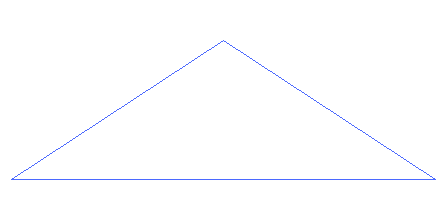 Animation courtesy of António Miguel de Campos. Repeating a simple process can create realistic looking landscapes, as the animation above illustrates. The process starts with a triangle subdividing into smaller
triangles, while randomly displacing the vertices up or down. The process is repeated again and again at smaller scales, until a somewhat realistic looking
landscape is formed out of the polygon mesh.
Click "New" to generate a new random landscape. Click and drag to view the landscape from different directions. <Shift>-click to zoom in. Drag the blue slider to change the water level. Applet courtesy of Yevgeny Demidov. Play with the landscape above. Create a few new landscapes by clicking "New." Adjust the values of the variables "L" and "Rc" and try to figure out what they change. Things get really interesting when you adjust the water level, which you can do by dragging the blue slider up or down. Lower the water level all the way, so that you drain the land and leave behind only the hills or mounatains. As you slowly raise the level of water back up, small lakes form. As you raise the water level higher, the lakes grow and start to merge. As the water level rises further and the lakes begin to take over, the mountain tops end up surrounded by water, and become... islands! Islands are mountains that poke out of the water. There are many examples of this all over the world, but one of the most impressive is the archipelago of Indonesia, in the
south Asian Sea. 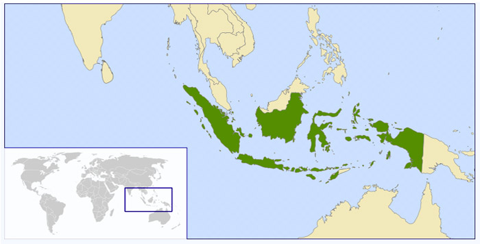 A map of Indonesia, showing its location in the world. It is quite well known that tectonic plates move around and crash into each other, causing earthquakes and building mountains. Less well known is that regions of the earth sometimes rise or fall by thousands of meters, often repeatedly. Indonesia, which now comprises 17,508 islands (!) is believed to have fallen some 2000 meters over the last several million years. This means that the islands of Indonesia are really just the peaks of mountains on a submerged continent!REF In the random landscape generator above, try to find values of the parameters that create islands similar to the map of Indonesia. L = 128 and Rc = 4 are reasonable values to start with. Now drain the water level to the bottom. This is equivalent to raising the whole land mass above sea level and turning the islands into mountain peaks. Perhaps someday in the distant future, Indonesia may rise again and its thousands of islands will join into a giant connected land mass. Of course, landmasses can rise and fall, but so can the sea level. A changing sea level will have equally dramatic results on the shapes of coastlines. In places where the land rises steeply, a change in the sea level makes only a small difference in the shape of the coastline. but in places where the land slopes gently up from the ocean, a relatively small change of sea level can have a drastic effect on the shape of the coastline.
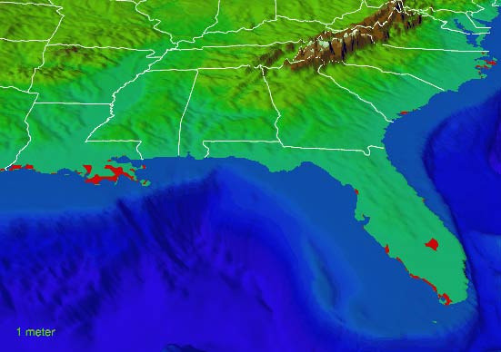
Mouseover the buttons on the right to see the effects of various sea level changes on the coastline of the southeastern US. Areas in red would be under water at the indicated rise in sea level. Images courtesy of National Oceanic and Atmospheric Administration. Question: As the sea level rises, does the area of land increase or decrease? [ ] Approximately what percentage of Florida's land area would remain after a sea level rise of 8 m? [ ] |
||
|
<- PREVIOUS NEXT -> © Fractal Foundation. |